


Voting District 300001, St. Lawrence County, New York
About
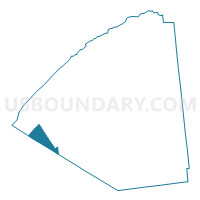
Outline

Summary
| Unique Area Identifier | 636377 |
| Name | Voting District 300001 |
| County | St. Lawrence County |
| State | New York |
| Area (square miles) | 39.24 |
| Land Area (square miles) | 37.88 |
| Water Area (square miles) | 1.36 |
| % of Land Area | 96.53 |
| % of Water Area | 3.47 |
| Latitude of the Internal Point | 44.32519130 |
| Longtitude of the Internal Point | -75.62382340 |
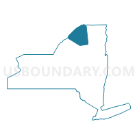
Maps

Graphs
Select a template below for downloading or customizing gragh for Voting District 300001, St. Lawrence County, New York


Neighbors
Neighoring Voting District (by Name) Neighboring Voting District on the Map
- Voting District 030001, Jefferson County, NY
- Voting District 030002, Jefferson County, NY
- Voting District 100001, St. Lawrence County, NY
- Voting District 100002, St. Lawrence County, NY
- Voting District 110005, St. Lawrence County, NY
- Voting District 120001, St. Lawrence County, NY
- Voting District 180001, St. Lawrence County, NY
- Voting District 190002, Jefferson County, NY
Top 10 Neighboring County Subdivision (by Population) Neighboring County Subdivision on the Map
- Gouverneur town, St. Lawrence County, NY (7,085)
- Theresa town, Jefferson County, NY (2,905)
- Fowler town, St. Lawrence County, NY (2,202)
- Antwerp town, Jefferson County, NY (1,846)
- Hammond town, St. Lawrence County, NY (1,191)
- Macomb town, St. Lawrence County, NY (906)
- Rossie town, St. Lawrence County, NY (877)
Top 10 Neighboring Unified School District (by Population) Neighboring Unified School District on the Map
- Indian River Central School District, NY (13,232)
- Gouverneur Central School District, NY (11,199)
- Hammond Central School District, NY (1,812)
Top 10 Neighboring State Legislative District Lower Chamber (by Population) Neighboring State Legislative District Lower Chamber on the Map
Top 10 Neighboring State Legislative District Upper Chamber (by Population) Neighboring State Legislative District Upper Chamber on the Map
Top 10 Neighboring 111th Congressional District (by Population) Neighboring 111th Congressional District on the Map
Top 10 Neighboring Census Tract (by Population) Neighboring Census Tract on the Map
- Census Tract 4927, St. Lawrence County, NY (7,085)
- Census Tract 4926, St. Lawrence County, NY (6,060)
- Census Tract 607, Jefferson County, NY (4,653)
- Census Tract 4928, St. Lawrence County, NY (2,880)
- Census Tract 4929, St. Lawrence County, NY (2,068)
- Census Tract 9800, Jefferson County, NY (18)